Field Guide to the Deep History Coast
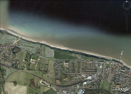
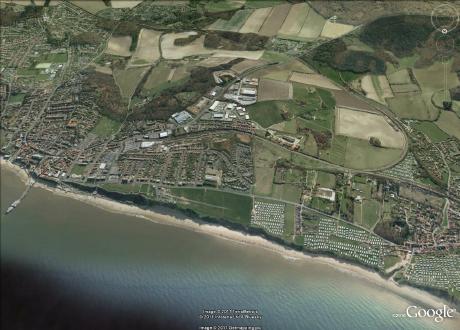
East Runton to Cromer
Parking: pay and display car park at East Runton (TG 201428) or pay and display at Runton Road Car Park, Cromer (TG 210425)
Access: from East Runton Gap or Cromer West Promenade
Glacial geology
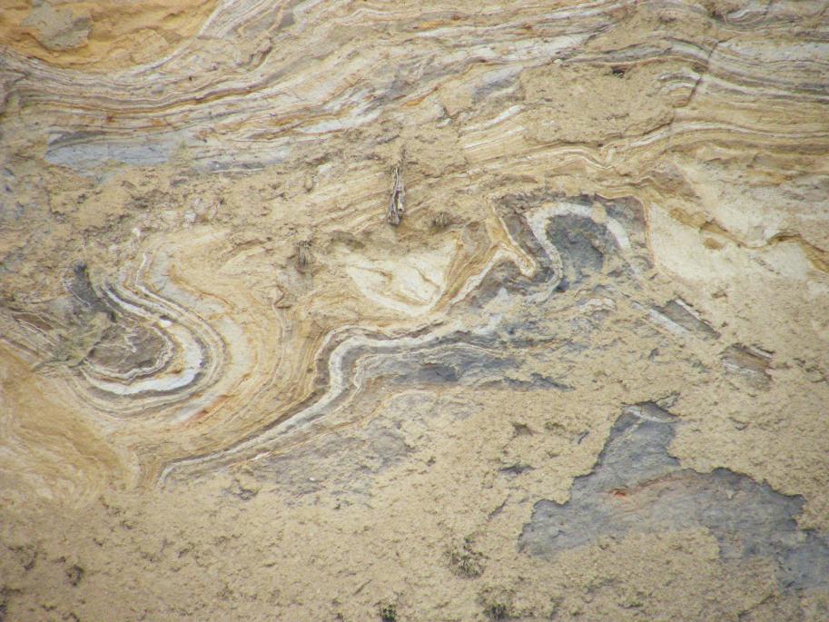
The cliff is composed of dramatically banded (sandy and chalky) and folded tills of the Contorted Drift. It displays open folding, with syngenetic basins of sand which show up particularly well at the end of winter after the frosts have cleaned up the cliff face. Phillips et. al (2008) interpret this as a proglacial zone with ice pushing in from the west and disturbing pre-existing glacial sediments, creating the open folds and low angle thrusts. In the synclines outwash sands were accumulating and filling up as the folds developed and the basins deepened to provide more accommodation space. Pale marls in the bottom of these basins have been mobilised and have ended up as prisms as the downstream side of the basin. The underlying dark tills have also risen up diapirically to form the limbs of the basins, with the downstream side usually being steep than the upstream.
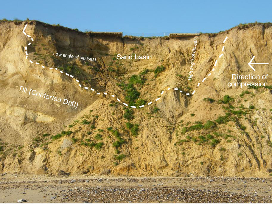
Above is an example of a banana-shaped sand basin near the west end of the section. Notice how the lower beds of sand are folded, especially on the right where they stand vertical, while the upper beds are only gently tilted. This shows how the basin was created by compressive forces that folded the pre-existing drift and as it formed sand was deposited into the hollow, only to become deformed as basin deepened and the right hand limb steepened to near vertical. Click here to see the full-sized image.
Cromer Forest-bed
There is little exposure of the pre-glacial Pleistocene but amongst the large flints on the low shore you may find patches of the Wroxham Crag (Pre-Pastonian) and below the tills in the cliff near the pill box you may see an exposure of orange gravels (possibly Pastonian to Cromerian age)). Both of these may contain fossils.
Prominent amongst the large flints on the foreshore are spectacular paramoudras. Large flint 'axes' collected from this part of the coast by J. Reid Moir (1923) were supposed to represent a primitive stone tool culture but modern archaeologists reject these as artefacts. As this section is a slight embayment between Cromer and East Runton, the beach is relatively stable and little of interest is exposed on the foreshore here nowadays. The foreshore has produced robust vertebrate fossils in the past. The so-called 'Lower Freshwater Bed' (probably 'Lower Pleistocene, Pre-Pastonian a' of West, 1980) formerly outcropped very low down the beach some 400m east of East Runton Gap, but this has not been seen in recent years.
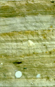
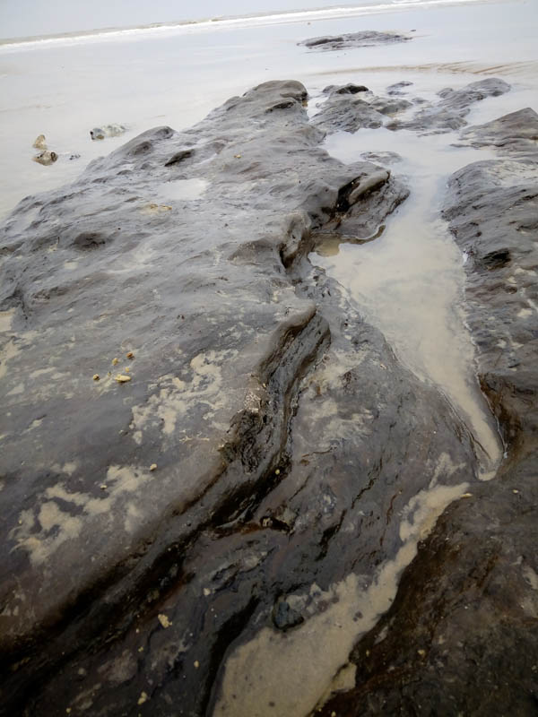
The Lower Freshwater Bed
In November 2018 an exposure was noted of a tough, dark brown organic mud in two patches showing through beach sand over a length of 13m, with bedding showing organic partings dipping around 10° to the WNW (see photos below). The long axis of the exposure trended WSW-ENE. It appeared to be a channel fill cut into the Chalk (there was a small patch of chalk 15m away at the same level). Not shelly, no macro fossils noticed to date. Location: 52°56'.26"N, 1°17'6.20"E (from Google Earth; may appear to be in the sea but it was very low tide); 135 paces (approximately 120m) north from the cliff base; 733 m east of East Runton gap. This is what Alfred Savin would describe as part of the Lower Freshwater Bed. Richard West noted an exposure which sounds very similar at 400m east of East Runton Gap (section ERA) and is possibly the same deposit. He found a single biozone, a Gramineae-Cyperaceae p.a.b., correlated with the Gramineae-Cyperaceae-Betula-Pinus p.a.b. of substage Pre-Pa d at Beeston Regis.

Chalk

Examining the pile of flint that is found at low water to the north of the World War 2 pill box that has fallen to the beach (north of Wyndham Park) I notice that it is very immature. That is, there are numerous chalk pebbles and the flints are often angular rather than smooth and rounded. This suggests that the material is recently eroded and hasn't yet had the opportunity to be reduced to smooth, rounded and resistant flint pebbles. I think it is a good bet that fossils will be found here in good condition, rather than having been pounded to smithereens by the waves. This area may prove fruitful for fossil hunters.
What might be the source and reason for the accumulation of Cretaceous debris at this point? I surmise that the source of the fresh flint and chalk pebbles can be found some 800 metres to the west where there is a large quantity of glaciotectonised chalk in the cliff (Wood Hill). Periodically the cliff falls to the beach and the chalk is eroded by the tide and a stream of material is carried by longshore drift to the east where it meets the flint band that runs across the beach to the north of the pill box. Here it accumulates amongst the large flints that are outcropping in the in situ chalk on the foreshore.
The Upper Cretaceous Chalk of Campanian age on the foreshore is only visible at low water and only then when the sand and shingle cover has been scoured away by favourable tides and winds. Chalk is not seen in situ any further east than under Cromer Pier, except where it is contained in glacially disturbed rafts that have raised it above its natural position, (for example see the Overstrand Sidestrand section).
Rock Armour at East Runton is more interesting than you might think
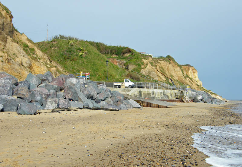
At the west end of this section of coastline, at East Runton Gap, rock armour has been emplaced to protect the concrete structures around this access point to the beach. These huge (1-3 tonne) blocks of imported stone are interesting geological features in their own right. They come from Bardon Hill Quarry in NW Leicestershire, where there is a late Precambrian (570 Ma) volcanic complex. These igneous and volcaniclastic rocks were created in an island arc setting, analogous to the islands of the West Indies today, such as the actively volcanic island of Montserrat. The rocks are andesitic in aspect and include some very graphic examples of a volcaniclastic rock known as Bardon Breccia. This consists of angular reddish-purple blocks of fine-grained laminated lagoonal silts that were blasted skywards by volcanic events and they then fell into the lagoon. There are blocks showing beds of ash that rained-out into shallow water, with structures such as graded bedding (which also shows which way up the rock was originally) and micro-faulting (that resulted from the rapid build-up of sediments in the lagoon). And there are also blocks of a rock called peperite, created when ejected 'bombs' of hot magma come into contact with wet sediments. This has caused a chemical reaction and a yellowish halo has formed around darker cores. One can spend a happy hour exploring the detailed structures on the surfaces of these blocks. It's not the kind of fieldwork one would normally expect to carry out in Norfolk. Click on the images to view full-sized images.
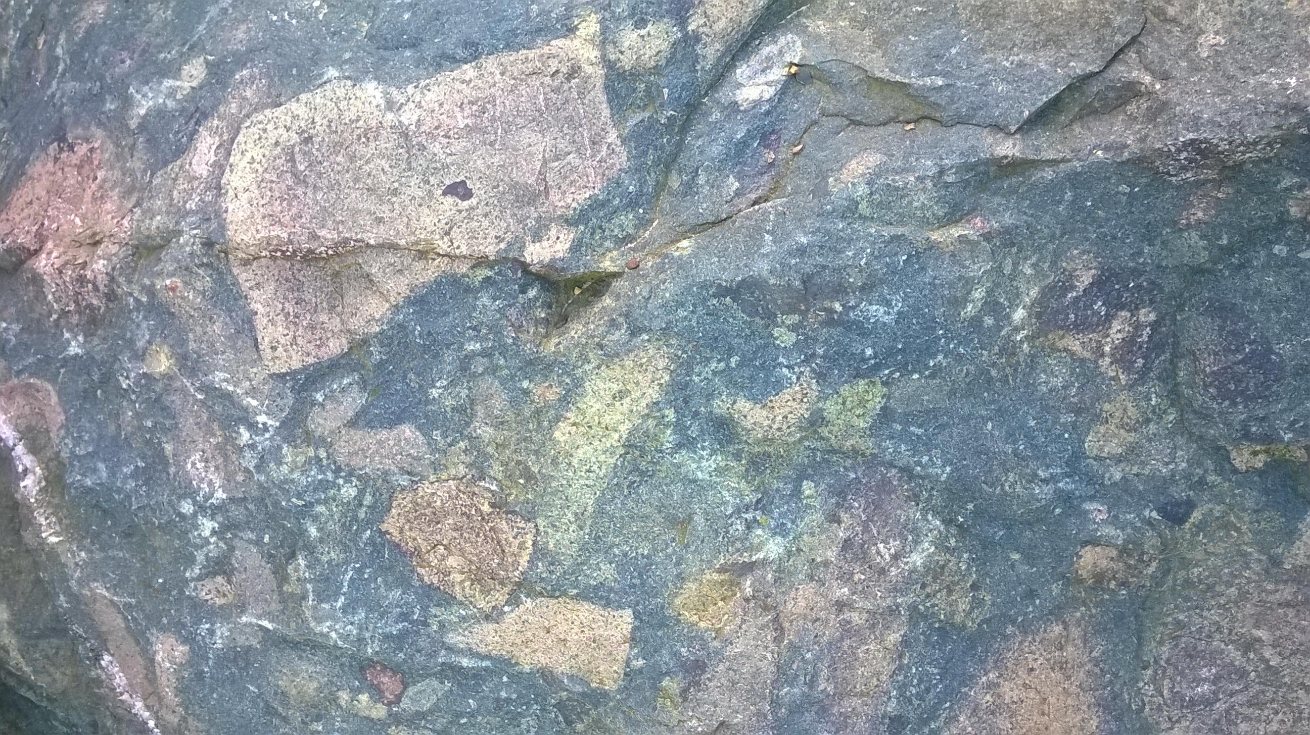 Peperite
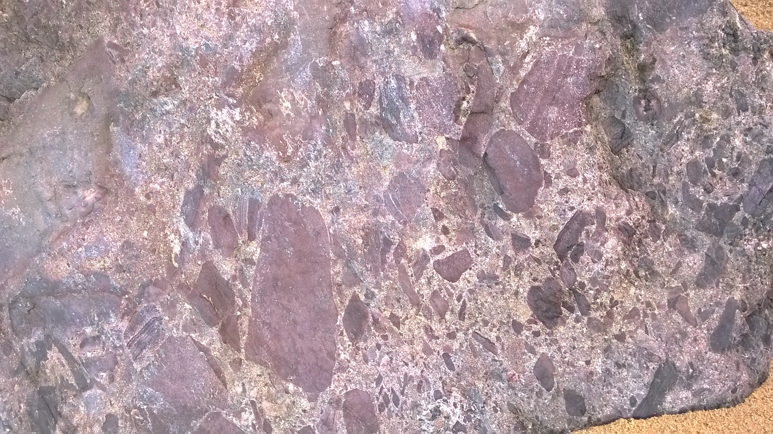 Bardon Breccia
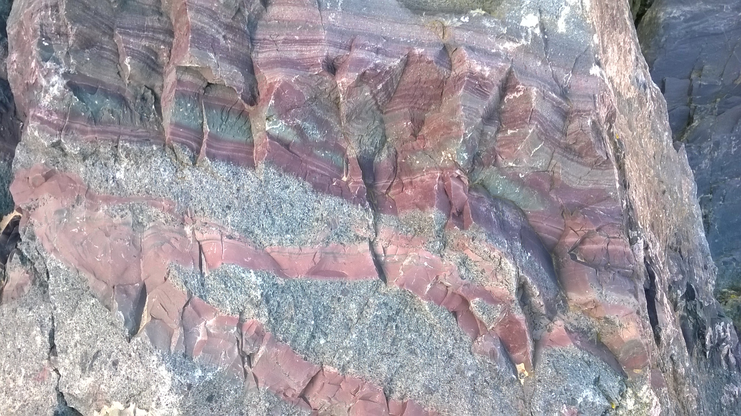 Volcaniclastic lagoonal sediments
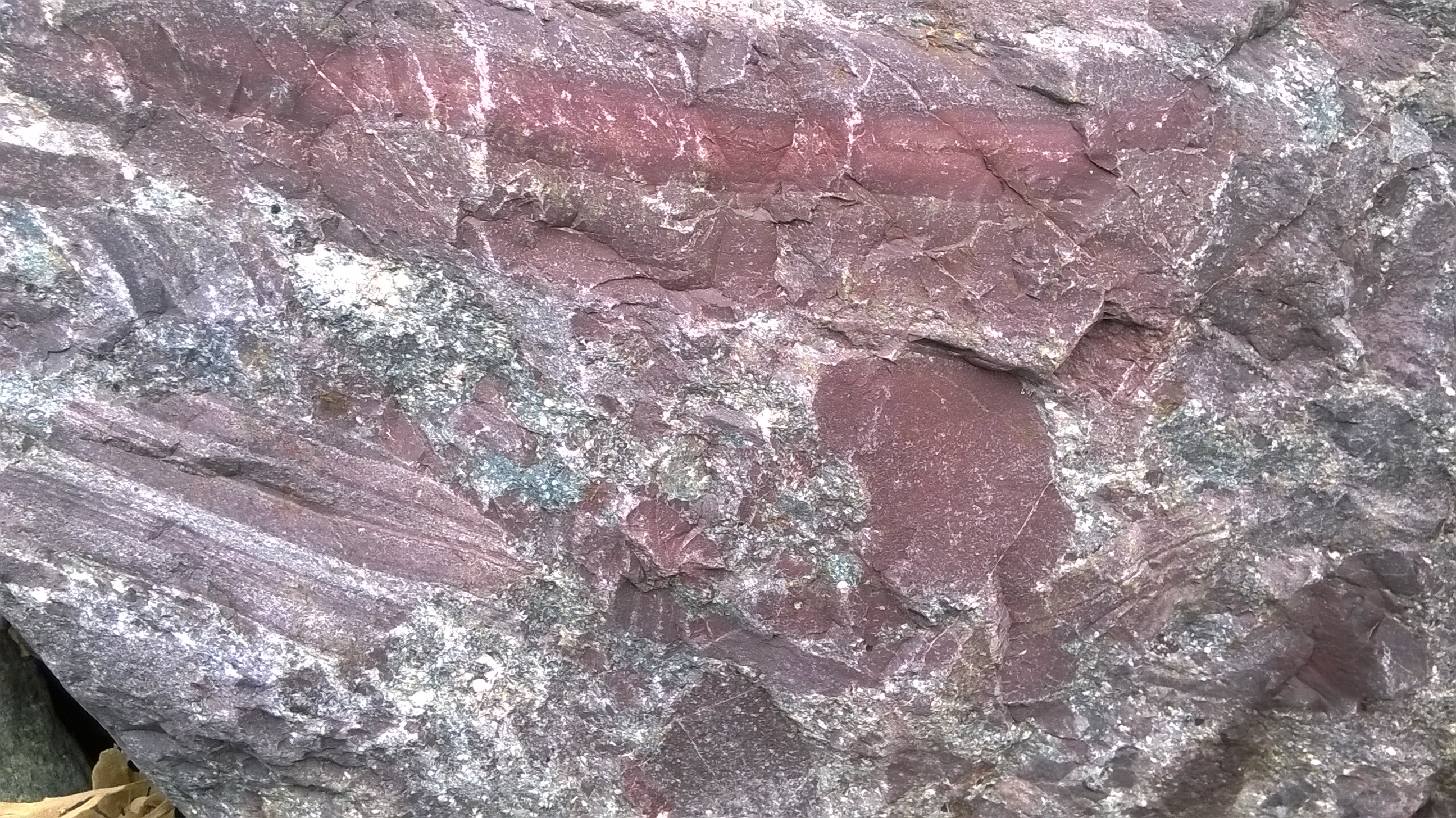 Brecciated blocks of laminated silts
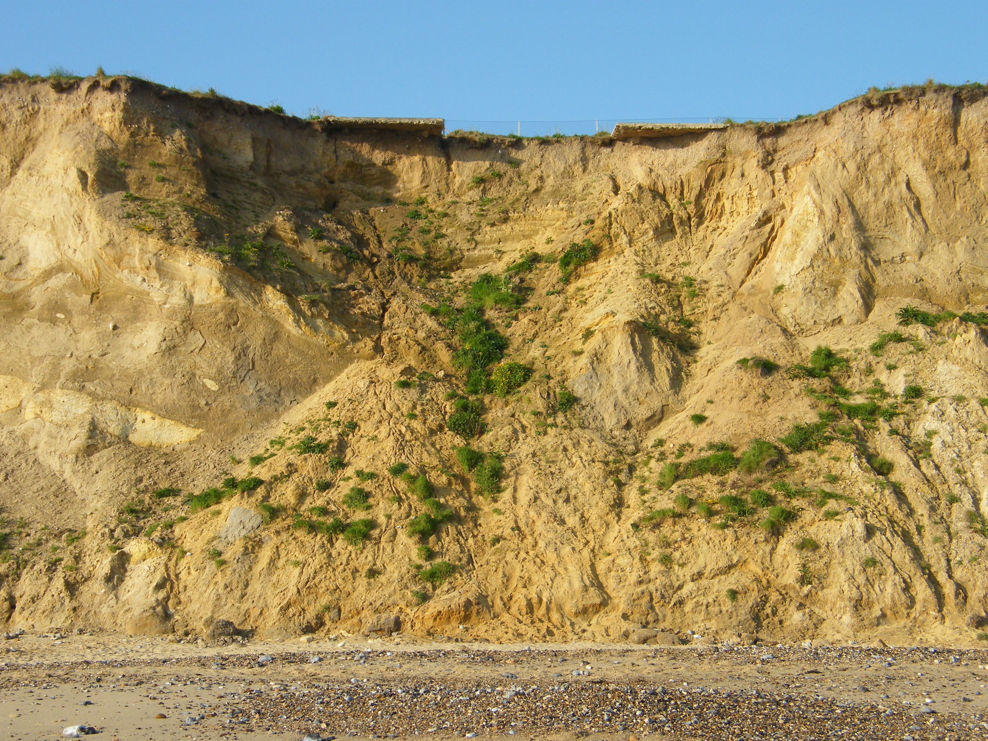
References
Moir, J. Reid, 1923. The Great Flint Implements of Cromer, Norfolk. W. E. Harrison, Ancient House Press, Ipswich.
West, R.G., 1980. The pre-glacial Pleistocene of the Norfolk and Suffolk Coasts. Cambridge University Press.